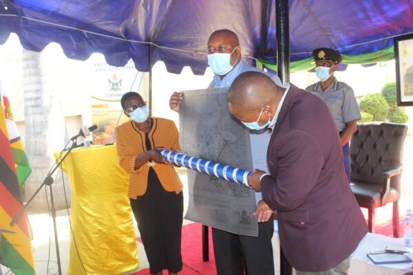
Minister of Mines and Mining Development Hon Winston Chitando has handed 14 brand new maps to Mashonaland Central provincial office.
Anerudo Mapuranga
The state of mining maps at most Ministry of Mines provincial Offices has lead to claim ownership disputes rising daily due to worn-out maps suitable for the trash.
Minister of Mines and Mining Development Hon Chitando says the Ministry has been working to reduce concession disputes creating various mechanisms the earliest being the issuance of new maps to all the provinces in the country with nearly 500 maps ready to be distributed to all provinces.
“Some of the disputes have been caused by tattered maps, we have come up with mechanisms ensuring that all disputes are resolved timeously and amicably.
“The province requested that for them to do their work efficiently they need 14 maps. We are therefore handing these maps to them ensuring that the US$12 Billion milestone is achieved,” Minister Chitando said.
The Minister is also in the process of digitalizing the allocation of mining claims after a successful pilot project in Manicaland where he spearheaded the adoption of the cadastre system which he touted as a solution to double allocation and corruption in the allocation of claims.
The computer-based cadastre system is expected to enhance transparency and accountability in the administration of mining titles.
The cadastre system will have all records of interest in the land such as licence holders’ rights, restrictions, and government activities.
The computerised mining register is also expected to be the central database for the storage of information on applications and licences.
It is also expected to reduce processing time for the issuance of mining titles and other mining services in line with best practices across the globe.
Currently, mining licence separations are marked on the ground by metal stakes, concrete beacons or some other fixed points surveyed using conventional methods such as theodolite or archaic methods involving tape and chains.


